Geolocate

Ursy topographic map

Click on the map to display elevation.

About this map

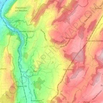
Name: Ursy topographic map, elevation, terrain.

Location: Ursy, District de la Glâne, Fribourg, Switzerland (46.60061 6.81729 46.66257 6.88117)

Average elevation: 733 m

Minimum elevation: 517 m

Maximum elevation: 908 m

Gear up for your next adventure:

🦯Trekking Poles - Reduced impact on joints for steep topographic climbs
🗺️Topographic Maps - Detailed maps to explore trails, mountains, and wilderness areas
🚲Handlebar Phone Mount - View topographic-map.com live while cycling
🦟Insect Repellent - Keep mosquitoes and black flies away in wooded areas
🥾Hiking Shoes - Durable and comfortable shoes for trail hiking

As an Amazon Associate, this site earns from qualifying purchases at no extra cost to you.