Geolocate

Changki topographic map

Click on the map to display elevation.

About this map

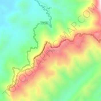
Name: Changki topographic map, elevation, terrain.

Location: Changki, Mangkolemba, Mokokchung, Nagaland, India (26.40184 94.36894 26.44184 94.40894)

Average elevation: 588 m

Minimum elevation: 237 m

Maximum elevation: 1,096 m

Gear up for your next adventure:

🧦Hiking Liner Socks - Thin base layer to prevent friction and blisters
🧥Insulated Jacket - Keep warm in cold outdoor conditions
🧴Sunscreen SPF - Broad-spectrum sunscreen for outdoor activities
🥾Trekking Poles - Adjustable trekking poles to reduce knee stress and improve stability
🧴Insect Repellent - Protect yourself from bugs during outdoor adventures

As an Amazon Associate, this site earns from qualifying purchases at no extra cost to you.