Geolocate

Prescott topographic map

Click on the map to display elevation.

About this map
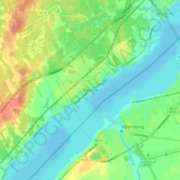
Name: Prescott topographic map, elevation, terrain.

Location: Prescott, Eastern Ontario, Ontario, K0E 1T0, Canada (44.67042 -75.55290 44.75042 -75.47290)

Average elevation: 89 m

Minimum elevation: 72 m

Maximum elevation: 121 m

Prescott trails, hiking, mountain biking, running and outdoor activities

Gear up for your next adventure:

🛶Waterproof Dry Bags - Keep electronics and clothes dry during river crossings
🗺️Topographic Maps - Detailed maps to explore trails, mountains, and wilderness areas
🥫Freeze-Dried Meals - Lightweight, high-calorie nutrition for multi-day treks
🧊Insulated Water Bottle - Keeps drinks cold in summer and prevents freezing in winter
🧤Thermal Hiking Gloves - Grip-enhanced gloves for cold-weather altitude trekking

As an Amazon Associate, this site earns from qualifying purchases at no extra cost to you.