Geolocate

Srisailam topographic map

Click on the map to display elevation.

About this map

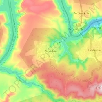
Name: Srisailam topographic map, elevation, terrain.

Location: Srisailam, Nandyal, Andhra Pradesh, 518100, India (16.03378 78.83271 16.11378 78.91271)

Average elevation: 437 m

Minimum elevation: 165 m

Maximum elevation: 712 m

Gear up for your next adventure:

🥾Waterproof Hiking Shoes - Durable shoes for wet and rugged trails
🧣Merino Neck Gaiter - Protects against wind, sun, and cold at high altitudes
Camping Coffee Maker - Brew fresh coffee anywhere on the topographic map
🪑Insulated Seat Pad - Protect your seat from cold rocks and wet logs
💧Reusable Water Bottle - Durable water bottles for hydration on trails

As an Amazon Associate, this site earns from qualifying purchases at no extra cost to you.