
Make a donation
Gear up for your next adventure:
As an Amazon Associate, this site earns from qualifying purchases at no extra cost to you.
Bergheim topographic map
Click on the map to display elevation.
Make a donation
Gear up for your next adventure:
As an Amazon Associate, this site earns from qualifying purchases at no extra cost to you.
Bergheim
Bergheim liegt am Fuße des Vogelsberges auf einer Höhe von 167 m ü. NN, etwa 2,5 km südöstlich des Stadtzentrums von Ortenberg und 6,5 km nordwestlich von Büdingen. Durch das Dorf fließt die Bleiche (Nidder).
Make a donation
Gear up for your next adventure:
As an Amazon Associate, this site earns from qualifying purchases at no extra cost to you.
About this map
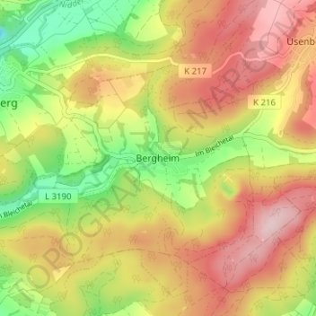
Name: Bergheim topographic map, elevation, terrain.
Location: Bergheim, Ortenberg, Wetteraukreis, Hessen, 63683, Deutschland (50.32652 9.06646 50.36652 9.10646)
Average elevation: 238 m
Minimum elevation: 101 m
Maximum elevation: 361 m
Make a donation
Gear up for your next adventure:
As an Amazon Associate, this site earns from qualifying purchases at no extra cost to you.