Geolocate

Haag topographic map

Click on the map to display elevation.

About this map

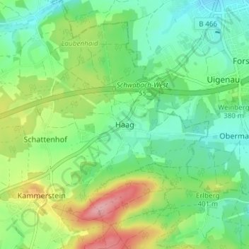
Name: Haag topographic map, elevation, terrain.

Location: Haag, Kammerstein, Landkreis Roth, Bayern, 91126, Deutschland (49.28464 10.97446 49.32464 11.01446)

Average elevation: 379 m

Minimum elevation: 338 m

Maximum elevation: 462 m

Gear up for your next adventure:

🧴Bear Spray Holster - Quick-access carry for essential Canadian wilderness safety
Lightweight Camping Tent - Portable shelter optimized for Canadian backcountry camping
🛏️Camping Sleeping Mat - Comfortable mats for sleeping outdoors
🔋Lithium AA Batteries - Long-lasting power that performs in extreme cold
🌬️Windproof Camp Stove - Efficient cooking even on exposed mountain peaks

As an Amazon Associate, this site earns from qualifying purchases at no extra cost to you.