
Thank you for supporting this site ❤️
Make a donation
Make a donation
Gear up for your next adventure:
As an Amazon Associate, this site earns from qualifying purchases at no extra cost to you.
Guayaramerín topographic map
Click on the map to display elevation.
Thank you for supporting this site ❤️
Make a donation
Make a donation
Gear up for your next adventure:
As an Amazon Associate, this site earns from qualifying purchases at no extra cost to you.
About this map
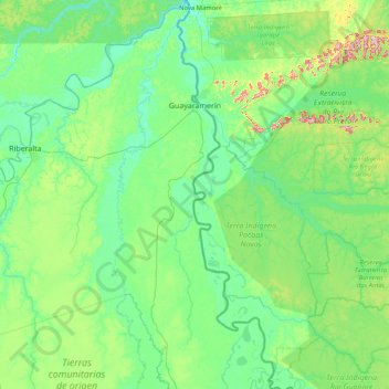
Name: Guayaramerín topographic map, elevation, terrain.
Location: Guayaramerín, Antonio Vaca Díez, Beni, Bolivia (-11.99876 -65.74157 -10.38055 -65.02042)
Average elevation: 151 m
Minimum elevation: 105 m
Maximum elevation: 436 m
Thank you for supporting this site ❤️
Make a donation
Make a donation
Gear up for your next adventure:
As an Amazon Associate, this site earns from qualifying purchases at no extra cost to you.