Geolocate

Randle topographic map

Click on the map to display elevation.

About this map

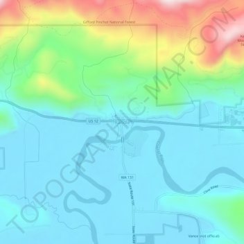
Name: Randle topographic map, elevation, terrain.

Location: Randle, Lewis County, Washington, United States (46.51511 -121.97704 46.55511 -121.93704)

Average elevation: 378 m

Minimum elevation: 260 m

Maximum elevation: 770 m

Gear up for your next adventure:

🧼Travel Hand Sanitizer - Keep hands clean when water is scarce
🚲Handlebar Phone Mount - View topographic-map.com live while cycling
🧦Crew Hiking Socks - Comfortable socks for long-distance hikes
🚲MTB Frame Bag - Carry tools and maps directly on your bicycle frame
🧦Thermal Socks - Warm socks for winter hiking or camping

As an Amazon Associate, this site earns from qualifying purchases at no extra cost to you.