Geolocate

Lubok Merbau topographic map

Click on the map to display elevation.

About this map

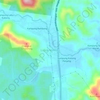
Name: Lubok Merbau topographic map, elevation, terrain.

Location: Lubok Merbau, Kuala Kangsar, Perak, Malaysia (4.78978 100.87235 4.82978 100.91235)

Average elevation: 104 m

Minimum elevation: 52 m

Maximum elevation: 338 m

Other topographic maps

Click on a map to view its topography, its elevation and its terrain.

Istana Iskandariah

Malaysia > Perak > Kuala Kangsar

Average elevation: 44 m

Kampung Baru Jerlun

Malaysia > Perak > Kuala Kangsar

Average elevation: 61 m

Gear up for your next adventure:

🦯Trekking Poles - Reduced impact on joints for steep topographic climbs
🧴Outdoor Sunscreen - High SPF protection for high-altitude UV exposure
🎒Backpack Rain Cover - External shield to keep your entire pack dry
💡Compact LED Flashlight - Powerful and portable flashlight for outdoor use
💡LED Camping Lantern - Illuminate your campsite with long-lasting lanterns

As an Amazon Associate, this site earns from qualifying purchases at no extra cost to you.