Geolocate

Germania topographic map

Click on the map to display elevation.

About this map

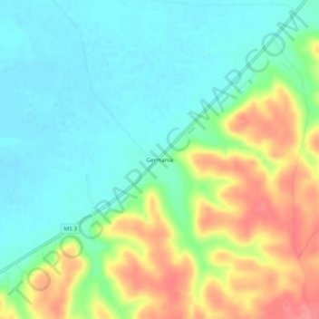
Name: Germania topographic map, elevation, terrain.

Location: Germania, Yazoo County, Mississippi, 39162, United States (32.58625 -90.61232 32.62625 -90.57232)

Average elevation: 55 m

Minimum elevation: 26 m

Maximum elevation: 105 m

Gear up for your next adventure:

🍽️Titanium Camping Spork - Ultralight and indestructible eating utensil
Family Camping Tent - Spacious tent suitable for family camping trips
🚲MTB Frame Bag - Carry tools and maps directly on your bicycle frame
🧰Survival Kit - Essential gear for emergencies in the wilderness
🧢Hiking Hat - Sun-protective and breathable hats for long treks

As an Amazon Associate, this site earns from qualifying purchases at no extra cost to you.