Geolocate

Nungba topographic map

Click on the map to display elevation.

About this map

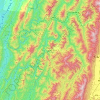
Name: Nungba topographic map, elevation, terrain.

Location: Nungba, Noney, Manipur, 795147, India (24.49584 93.17153 24.83161 93.75492)

Average elevation: 691 m

Minimum elevation: 30 m

Maximum elevation: 2,061 m

Gear up for your next adventure:

🥘Camping Cookware Set - Compact nesting pots and pans for trail cooking
🗺️Topographic Maps - Detailed maps to explore trails, mountains, and wilderness areas
🪑Insulated Seat Pad - Protect your seat from cold rocks and wet logs
🥾Waterproof Hiking Boots - Essential footwear for rugged terrain and wet Canadian trails
🥫Freeze-Dried Meals - Lightweight, high-calorie nutrition for multi-day treks

As an Amazon Associate, this site earns from qualifying purchases at no extra cost to you.