Geolocate

Natagaima topographic map

Click on the map to display elevation.

Natagaima

Altitud de la cabecera municipal: 326 msnm

About this map

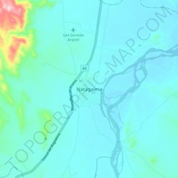
Name: Natagaima topographic map, elevation, terrain.

Location: Natagaima, Sur, Tolima, Colombia (3.58417 -75.13306 3.66417 -75.05306)

Average elevation: 342 m

Minimum elevation: 307 m

Maximum elevation: 615 m

Gear up for your next adventure:

🕯️Camping Lantern - Illuminates your entire campsite with high-efficiency LEDs
🥾Waterproof Hiking Boots - Boots keeping your feet dry in wet conditions
🥾Trail Hiking Shoes - Durable shoes designed for rugged trails
Camping Groundsheet - Protect your tent from moisture and dirt
🚲Bike Repair Kit - Essential tools for on-trail mechanical issues

As an Amazon Associate, this site earns from qualifying purchases at no extra cost to you.