
Thank you for supporting this site ❤️
Make a donation
Make a donation
Gear up for your next adventure:
As an Amazon Associate, this site earns from qualifying purchases at no extra cost to you.
Avondale topographic map
Click on the map to display elevation.
Thank you for supporting this site ❤️
Make a donation
Make a donation
Gear up for your next adventure:
As an Amazon Associate, this site earns from qualifying purchases at no extra cost to you.
About this map
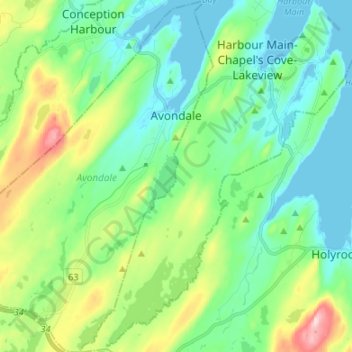
Name: Avondale topographic map, elevation, terrain.
Location: Avondale, Newfoundland, Newfoundland and Labrador, Canada (47.35899 -53.27292 47.44982 -53.17800)
Average elevation: 72 m
Minimum elevation: -3 m
Maximum elevation: 274 m
Newfoundland and Labrador trails, hiking, mountain biking, running and outdoor activities
Thank you for supporting this site ❤️
Make a donation
Make a donation
Gear up for your next adventure:
As an Amazon Associate, this site earns from qualifying purchases at no extra cost to you.