Geolocate

Boden topographic map

Click on the map to display elevation.

About this map
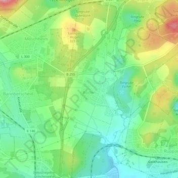
Name: Boden topographic map, elevation, terrain.

Location: Boden, Montabaur, Westerwaldkreis, Rhineland-Palatinate, Germany (50.45800 7.84833 50.48740 7.86532)

Average elevation: 281 m

Minimum elevation: 232 m

Maximum elevation: 364 m

Gear up for your next adventure:

🔋Lithium AA Batteries - Long-lasting power that performs in extreme cold
🧰Multitool Knife - Compact and versatile tool for outdoor use
⛺Backpacking Tent - Lightweight tent for long-distance hiking trips
🪑Insulated Seat Pad - Protect your seat from cold rocks and wet logs
🧊Portable Cooler - Keep food and drinks cold during outdoor adventures

As an Amazon Associate, this site earns from qualifying purchases at no extra cost to you.