
Thank you for supporting this site ❤️
Make a donation
Make a donation
Gear up for your next adventure:
As an Amazon Associate, this site earns from qualifying purchases at no extra cost to you.
Rumiloma topographic map
Click on the map to display elevation.
Thank you for supporting this site ❤️
Make a donation
Make a donation
Gear up for your next adventure:
As an Amazon Associate, this site earns from qualifying purchases at no extra cost to you.
About this map
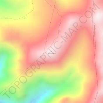
Name: Rumiloma topographic map, elevation, terrain.
Location: Rumiloma, Angochagua, Ibarra, Imbabura, Ecuador (0.20985 -78.04495 0.20995 -78.04485)
Average elevation: 3,665 m
Minimum elevation: 3,217 m
Maximum elevation: 3,900 m
Thank you for supporting this site ❤️
Make a donation
Make a donation
Gear up for your next adventure:
As an Amazon Associate, this site earns from qualifying purchases at no extra cost to you.