Geolocate

Dossi topographic map

Click on the map to display elevation.

About this map

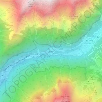
Name: Dossi topographic map, elevation, terrain.

Location: Dossi, Valbondione, Bergamo, Lombardia, 24020, Italia (46.01127 9.96506 46.05127 10.00506)

Average elevation: 1,449 m

Minimum elevation: 780 m

Maximum elevation: 2,513 m

Other topographic maps

Click on a map to view its topography, its elevation and its terrain.

Nord

Italia > Lombardia > Bergamo > Valbondione

Average elevation: 2,196 m

Gear up for your next adventure:

🔋Solar Power Bank - Keep your GPS and devices charged during long outdoor trips
🥾Waterproof Hiking Boots - Boots keeping your feet dry in wet conditions
🥾Trail Hiking Shoes - Durable shoes designed for rugged trails
🥾Trail Hiking Boots - Supportive boots for rough trails
🛶Waterproof Dry Bags - Keep electronics and clothes dry during river crossings

As an Amazon Associate, this site earns from qualifying purchases at no extra cost to you.