
Thank you for supporting this site ❤️
Make a donation
Make a donation
Gear up for your next adventure:
As an Amazon Associate, this site earns from qualifying purchases at no extra cost to you.
Soutelo topographic map
Click on the map to display elevation.
Thank you for supporting this site ❤️
Make a donation
Make a donation
Gear up for your next adventure:
As an Amazon Associate, this site earns from qualifying purchases at no extra cost to you.
About this map
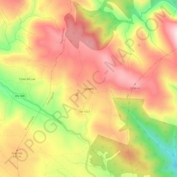
Name: Soutelo topographic map, elevation, terrain.
Location: Soutelo, Carragosa, Bragança, Distrito de Bragança, Portugal (41.86697 -6.82298 41.90697 -6.78298)
Average elevation: 901 m
Minimum elevation: 679 m
Maximum elevation: 1,059 m
Thank you for supporting this site ❤️
Make a donation
Make a donation
Gear up for your next adventure:
As an Amazon Associate, this site earns from qualifying purchases at no extra cost to you.