
Mara Lake topographic map
Click on the map to display elevation.
Mara Lake
The lake is 35.3 kilometres (21.9 mi) long. The surface area is about 1,943 hectares (4,800 acres) and elevation is 338 metres (1,109 ft) above sea level. The mean and maximum depth is 18 metres (59 ft).
About this map
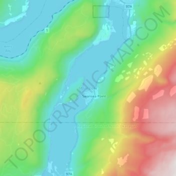
Name: Mara Lake topographic map, elevation, terrain.
Average elevation: 826 m
Minimum elevation: 336 m
Maximum elevation: 2,052 m
Columbia-Shuswap Regional District trails, hiking, mountain biking, running and outdoor activities