Geolocate

Arnstein topographic map

Click on the map to display elevation.

About this map

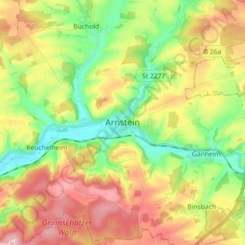
Name: Arnstein topographic map, elevation, terrain.

Location: Arnstein, Landkreis Main-Spessart, Bayern, 97450, Deutschland (49.93810 9.92891 50.01810 10.00891)

Average elevation: 279 m

Minimum elevation: 196 m

Maximum elevation: 380 m

Gear up for your next adventure:

🧊Insulated Water Bottle - Keeps drinks cold in summer and prevents freezing in winter
🧢Outdoor Cap - Protective cap for sun and rain during hikes
🥾Light Trekking Boots - Supportive boots for multi-day treks
🥾Waterproof Hiking Boots - Essential footwear for rugged terrain and wet Canadian trails
👖Convertible Hiking Pants - Zip-off legs to adapt to changing weather conditions

As an Amazon Associate, this site earns from qualifying purchases at no extra cost to you.