Geolocate

Padula topographic map

Click on the map to display elevation.

About this map

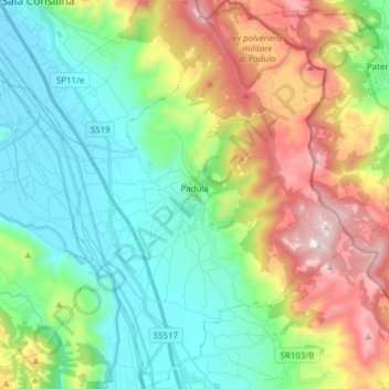
Name: Padula topographic map, elevation, terrain.

Location: Padula, Salerno, Campania, Italy (40.28127 15.60599 40.39827 15.72110)

Average elevation: 787 m

Minimum elevation: 446 m

Maximum elevation: 1,490 m

Gear up for your next adventure:

🎒Hiking Backpack - Lightweight and ergonomic backpacks for day hikes or multi-day treks
👟Trail Running Shoes - Agile footwear for fast-paced topographic exploration
🥘Camping Cookware Set - Compact nesting pots and pans for trail cooking
🥾Trekking Boots - Durable boots for long-distance trekking
🧴Outdoor Sunscreen - High SPF protection for high-altitude UV exposure

As an Amazon Associate, this site earns from qualifying purchases at no extra cost to you.