
Thank you for supporting this site ❤️
Make a donation
Make a donation
Gear up for your next adventure:
As an Amazon Associate, this site earns from qualifying purchases at no extra cost to you.
Lassolaz topographic map
Click on the map to display elevation.
Thank you for supporting this site ❤️
Make a donation
Make a donation
Gear up for your next adventure:
As an Amazon Associate, this site earns from qualifying purchases at no extra cost to you.
About this map
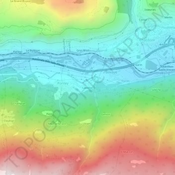
Name: Lassolaz topographic map, elevation, terrain.
Location: Lassolaz, Bovaye, Pontey, Valle d'Aosta, 11023, Italia (45.71784 7.57320 45.75784 7.61320)
Average elevation: 899 m
Minimum elevation: 440 m
Maximum elevation: 1,716 m
Thank you for supporting this site ❤️
Make a donation
Make a donation
Gear up for your next adventure:
As an Amazon Associate, this site earns from qualifying purchases at no extra cost to you.