
Thank you for supporting this site ❤️
Make a donation
Make a donation
Gear up for your next adventure:
As an Amazon Associate, this site earns from qualifying purchases at no extra cost to you.
Hukumpeta topographic map
Click on the map to display elevation.
Thank you for supporting this site ❤️
Make a donation
Make a donation
Gear up for your next adventure:
As an Amazon Associate, this site earns from qualifying purchases at no extra cost to you.
About this map
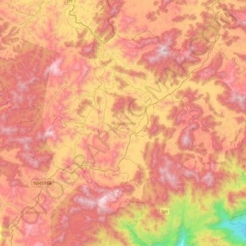
Name: Hukumpeta topographic map, elevation, terrain.
Location: Hukumpeta, Alluri Sitharama Raju, Andhra Pradesh, India (18.00159 82.62019 18.25450 82.97094)
Average elevation: 1,034 m
Minimum elevation: 112 m
Maximum elevation: 1,669 m
Thank you for supporting this site ❤️
Make a donation
Make a donation
Gear up for your next adventure:
As an Amazon Associate, this site earns from qualifying purchases at no extra cost to you.