
Sangolqui topographic map
Interactive map
Click on the map to display elevation.
About this map
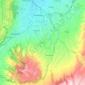
Name: Sangolqui topographic map, elevation, terrain.
Location: Sangolqui, Pichincha, Ecuador (-0.50700 -78.48464 -0.29076 -78.39376)
Average elevation: 3,015 m
Minimum elevation: 2,436 m
Maximum elevation: 4,249 m
Other topographic maps
Click on a map to view its topography, its elevation and its terrain.