Geolocate

Coyame topographic map

Click on the map to display elevation.

About this map

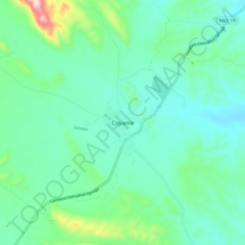
Name: Coyame topographic map, elevation, terrain.

Location: Coyame, Coyame del Sotol, Chihuahua, Mexico (29.42151 -105.13461 29.50151 -105.05461)

Average elevation: 1,255 m

Minimum elevation: 1,157 m

Maximum elevation: 1,647 m

Gear up for your next adventure:

🔦LED Flashlight - Powerful and long-lasting flashlight for camping and emergencies
🧤Thermal Hiking Gloves - Grip-enhanced gloves for cold-weather altitude trekking
Camping Tent - Weather-resistant tents suitable for 2 to 6 people
🧢Sun Protection Cap - Breathable cap to protect from sun exposure
🥾Approach Boots - Comfortable boots for hiking and climbing approaches

As an Amazon Associate, this site earns from qualifying purchases at no extra cost to you.