Geolocate

Comuna 1 topographic map

Click on the map to display elevation.

About this map

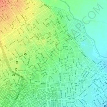
Name: Comuna 1 topographic map, elevation, terrain.

Location: Comuna 1, Valledupar, Cesar, 200001, Colombia (10.46160 -73.25761 10.48153 -73.23264)

Average elevation: 166 m

Minimum elevation: 145 m

Maximum elevation: 194 m

Other topographic maps

Click on a map to view its topography, its elevation and its terrain.

Atanquez

Colombia > Cesar > Valledupar

Average elevation: 900 m

Río Seco

Colombia > Cesar > Valledupar

Average elevation: 147 m

Valledupar

Colombia > Cesar > Valledupar

Average elevation: 306 m

Alto Santa Lucia

Colombia > Cesar > Valledupar

Average elevation: 206 m

Gear up for your next adventure:

🥾Light Hiking Boots - Lightweight and comfortable boots for day hikes
🥾Lightweight Hiking Shoes - Comfortable shoes for day hikes
🔦LED Headtorch - Bright and durable light for night activities
🩹Moleskin Blister Pads - Direct protection for painful foot pressure points
🧢Hiking Sun Hat - Wide-brimmed protection for exposed mountain ridges

As an Amazon Associate, this site earns from qualifying purchases at no extra cost to you.