Geolocate

Cooper Peak topographic map

Click on the map to display elevation.

About this map
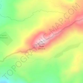
Name: Cooper Peak topographic map, elevation, terrain.

Location: Cooper Peak, Tuolumne County, California, United States (38.24045 -119.85774 38.24055 -119.85764)

Average elevation: 2,694 m

Minimum elevation: 2,470 m

Maximum elevation: 2,922 m

Other topographic maps

Click on a map to view its topography, its elevation and its terrain.

Columbia

United States > California > Tuolumne County

Columbia is located along State Route 49 just north of Sonora, at an altitude of 2,139 feet (652 m).

Average elevation: 672 m

Siesta Lake

United States > California > Tuolumne County

Average elevation: 2,480 m

East Sonora

United States > California > Tuolumne County

Average elevation: 675 m

Budd Lake

United States > California > Tuolumne County

Average elevation: 3,101 m

Pinecrest Lake

United States > California > Tuolumne County

Average elevation: 1,799 m

Mono Vista

United States > California > Tuolumne County

Average elevation: 929 m

Gear up for your next adventure:

🧶550 Survival Paracord - Versatile utility cord for emergency repairs and rigging
🔭Outdoor Binoculars - Lightweight binoculars for birdwatching and hiking
🥾Waterproof Hiking Boots - Boots keeping your feet dry in wet conditions
🥾Trail Hiking Shoes - Durable shoes designed for rugged trails
💧Filtered Water Bottle - Safe drinking water on the go

As an Amazon Associate, this site earns from qualifying purchases at no extra cost to you.