Geolocate

Kiltarlity topographic map

Click on the map to display elevation.

About this map

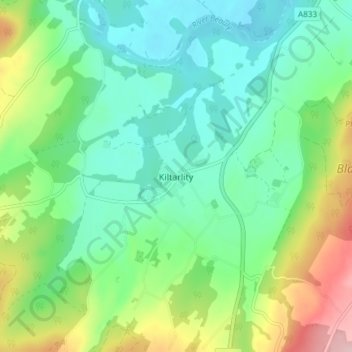
Name: Kiltarlity topographic map, elevation, terrain.

Location: Kiltarlity, Highland, Scotland, IV4 7HQ, United Kingdom (57.42131 -4.50748 57.46131 -4.46748)

Average elevation: 66 m

Minimum elevation: 4 m

Maximum elevation: 215 m

Gear up for your next adventure:

🥾Light Hiking Boots - Lightweight and comfortable boots for day hikes
🧢Hiking Hat - Sun-protective and breathable hats for long treks
🥾Durable Hiking Shoes - Long-lasting shoes for frequent hiking
🚲MTB Frame Bag - Carry tools and maps directly on your bicycle frame
Camping Tent - Weather-resistant tents suitable for 2 to 6 people

As an Amazon Associate, this site earns from qualifying purchases at no extra cost to you.