Geolocate

Pupnat topographic map

Click on the map to display elevation.

About this map

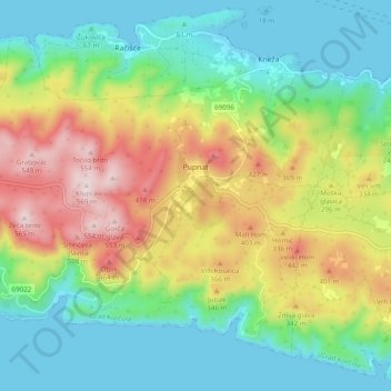
Name: Pupnat topographic map, elevation, terrain.

Location: Pupnat, Grad Korčula, Dubrovnik-Neretva County, 20274, Croatia (42.91701 16.97603 42.97550 17.07321)

Average elevation: 199 m

Minimum elevation: 0 m

Maximum elevation: 565 m

Other topographic maps

Click on a map to view its topography, its elevation and its terrain.

Gear up for your next adventure:

🥾Mountain Trail Shoes - High-traction shoes for mountain trails
🧴Insect Repellent - Protect yourself from bugs during outdoor adventures
🍽️Titanium Camping Spork - Ultralight and indestructible eating utensil
Lightweight Backpacking Tent - Compact tent for efficient hiking trips
🔭Outdoor Binoculars - Lightweight binoculars for birdwatching and hiking

As an Amazon Associate, this site earns from qualifying purchases at no extra cost to you.