Geolocate

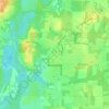
Compass Lake topographic map

Click on the map to display elevation.

About this map

Name: Compass Lake topographic map, elevation, terrain.

Location: Compass Lake, Jackson County, Florida, 32420, United States (30.57269 -85.41270 30.61269 -85.37270)

Average elevation: 66 m

Minimum elevation: 44 m

Maximum elevation: 98 m

Other topographic maps

Click on a map to view its topography, its elevation and its terrain.

Sneads

United States > Florida > Jackson County

Average elevation: 39 m

Graceville

United States > Florida > Jackson County

Jackson County is a rural community primarily composed of business in agriculture, manufacturing, service, and retail trade. In addition, many government facilities are located within the county, including a federal prison and three state correctional institutions. Elevation ranges from 50 to 330 feet (100 m)…

Average elevation: 48 m
Jacob City

United States > Florida > Jackson County

Average elevation: 43 m

Campbellton

United States > Florida > Jackson County

Average elevation: 46 m

Malone

United States > Florida > Jackson County

Average elevation: 44 m

Greenwood

United States > Florida > Jackson County

Average elevation: 39 m

Gear up for your next adventure:

☕Camping Coffee Maker - Brew fresh coffee anywhere on the topographic map
🔦LED Headlamp - Hands-free lighting for early morning starts or late finishes
🧰Multitool Knife - Compact and versatile tool for outdoor use
🧥Thermal Layer - Insulating layer for cold outdoor conditions
🥾Hiking Shorts - Breathable shorts suitable for summer hikes

As an Amazon Associate, this site earns from qualifying purchases at no extra cost to you.