Geolocate

Fengdu topographic map

Click on the map to display elevation.

About this map

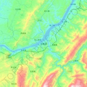
Name: Fengdu topographic map, elevation, terrain.

Location: Fengdu, Fengdu County, 渝东北三峡库区城镇群区位, Chongqing, China (29.70645 107.56577 30.02645 107.88577)

Average elevation: 538 m

Minimum elevation: 128 m

Maximum elevation: 1,703 m

Gear up for your next adventure:

🥾Hiking Shoes - Durable and comfortable shoes for trail hiking
🔦LED Headtorch - Bright and durable light for night activities
🥾Trail Running Boots - Durable shoes designed for trail running
💧Hydration Bladder - Hands-free hydration solution for long treks
🔦LED Flashlight - Powerful and long-lasting flashlight for camping and emergencies

As an Amazon Associate, this site earns from qualifying purchases at no extra cost to you.