Geolocate

Sersi topographic map

Click on the map to display elevation.

About this map

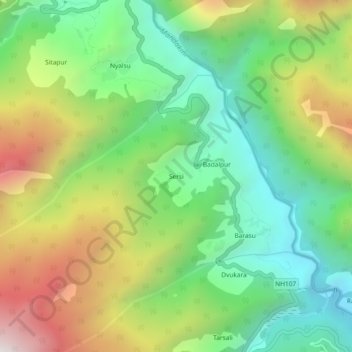
Name: Sersi topographic map, elevation, terrain.

Location: Sersi, Ukhimath, Rudraprayag, Uttarakhand, 246471, India (30.58414 78.99455 30.62414 79.03455)

Average elevation: 1,942 m

Minimum elevation: 1,384 m

Maximum elevation: 2,842 m

Gear up for your next adventure:

🔋Emergency Crank Radio - Weather alerts and power without needing batteries
❄️Traction Ice Cleats - Slip-on spikes for icy trails and winter hiking
🧼Travel Hand Sanitizer - Keep hands clean when water is scarce
🧥Ultralight Puffy Jacket - Maximum warmth that packs down to the size of an orange
🛰️Satellite Messenger - Emergency communication for areas with no cell service

As an Amazon Associate, this site earns from qualifying purchases at no extra cost to you.