Geolocate

Silbersee topographic map

Click on the map to display elevation.

About this map
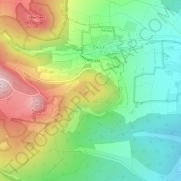
Name: Silbersee topographic map, elevation, terrain.

Location: Silbersee, Roth, Hausen, Fladungen (VGem), Landkreis Rhön-Grabfeld, Bayern, 97647, Deutschland (50.48275 10.11483 50.48338 10.11566)

Average elevation: 526 m

Minimum elevation: 404 m

Maximum elevation: 715 m

Other topographic maps

Click on a map to view its topography, its elevation and its terrain.

Silbersee

Deutschland > Bayern > Landkreis Rhön-Grabfeld > Hausen > Roth

Average elevation: 528 m

Gear up for your next adventure:

🛶Waterproof Dry Bags - Keep electronics and clothes dry during river crossings
Bushcraft Tarp - Versatile emergency shelter or gear protection
Camping Coffee Maker - Brew fresh coffee anywhere on the topographic map
🕯️Camping Lantern - Illuminates your entire campsite with high-efficiency LEDs
🎒Backpack Rain Cover - External shield to keep your entire pack dry

As an Amazon Associate, this site earns from qualifying purchases at no extra cost to you.