

Narok topographic map
Click on the map to display elevation.
Narok
Narok (sometimes referred to as Narok Town) is a town west of Nairobi that supports Kenya's economy in south-west of the country, along the Great Rift Valley. Narok is the district capital of the Narok County and stands as the major centre of commerce in the district. Narok has a population of around 40,000 people, mostly Maasai. The elevation of Narok is 1827 metres (5,997 feet) in altitude.
About this map
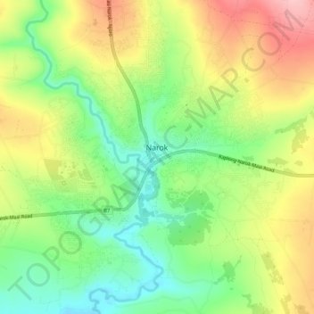
Name: Narok topographic map, elevation, terrain.
Location: Narok, Kenya (-1.11290 35.84274 -1.06770 35.89511)
Average elevation: 1,904 m
Minimum elevation: 1,829 m
Maximum elevation: 1,998 m
Other topographic maps
Click on a map to view its topography, its elevation and its terrain.
Narok
Narok (sometimes referred to as Narok Town) is a town west of Nairobi that supports Kenya's economy in south-west of the country, along the Great Rift Valley. Narok is the district capital of the Narok County and stands as the major centre of commerce in the district. Narok has a population of around 40,000…
Average elevation: 1,904 m