Geolocate

Bettiah topographic map

Click on the map to display elevation.

About this map

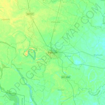
Name: Bettiah topographic map, elevation, terrain.

Location: Bettiah, West Champaran, Bihar, 845438, India (26.64230 84.34740 26.96230 84.66740)

Average elevation: 75 m

Minimum elevation: 69 m

Maximum elevation: 87 m

Other topographic maps

Click on a map to view its topography, its elevation and its terrain.

Bettiah

India > Bihar > Bettiah

Average elevation: 75 m

Gear up for your next adventure:

💧Filtered Water Bottle - Safe drinking water on the go
🧣Evaporative Cooling Towel - Beat the heat during intense summer climbs
🌬️Windproof Camp Stove - Efficient cooking even on exposed mountain peaks
🥾Trail Running Shoes - Lightweight and durable shoes for trail running
🧭GPS Handheld Device - Reliable GPS navigation for outdoor adventures

As an Amazon Associate, this site earns from qualifying purchases at no extra cost to you.