Geolocate

Foz topographic map

Click on the map to display elevation.

About this map

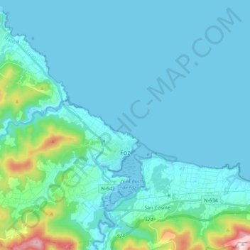
Name: Foz topographic map, elevation, terrain.

Location: Foz, A Mariña Central, Lugo, Galicia, Spain (43.52044 -7.40283 43.64477 -7.24467)

Average elevation: 57 m

Minimum elevation: -2 m

Maximum elevation: 502 m

Other topographic maps

Click on a map to view its topography, its elevation and its terrain.

Foz

Spain > Galicia > A Mariña Central > Foz

Average elevation: 43 m

Gear up for your next adventure:

🛌Down Sleeping Bag - Superior warmth-to-weight ratio for cold nights
Lightweight Backpacking Tent - Compact tent for efficient hiking trips
🧊Portable Cooler - Keep food and drinks cold during outdoor adventures
🔨Vehicle Emergency Tool - Safety tool for remote road trips to trailheads
🧤Insulated Winter Gloves - Heavy-duty protection for sub-zero Canadian adventures

As an Amazon Associate, this site earns from qualifying purchases at no extra cost to you.