
Uselu topographic map
Interactive map
Click on the map to display elevation.
About this map
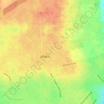
Name: Uselu topographic map, elevation, terrain.
Location: Uselu, Egor, Edo State, 11012, Nigeria (6.36509 5.59355 6.40509 5.63355)
Average elevation: 100 m
Minimum elevation: 69 m
Maximum elevation: 116 m