Geolocate

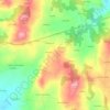
Remonde topographic map

Click on the map to display elevation.

About this map

Name: Remonde topographic map, elevation, terrain.

Location: Remonde, Palas de Rei, Ulloa, Lugo, Galicia, 27203, España (42.84724 -7.97540 42.88724 -7.93540)

Average elevation: 445 m

Minimum elevation: 335 m

Maximum elevation: 544 m

Other topographic maps

Click on a map to view its topography, its elevation and its terrain.
Lestedo

España > Galicia > Ulloa > Palas de Rei

Average elevation: 610 m

Gear up for your next adventure:

🧰Emergency Multi-Tool - Compact multi-tool for outdoor survival
🎒Hiking Backpack - Lightweight and ergonomic backpacks for day hikes or multi-day treks
🌬️Windproof Camp Stove - Efficient cooking even on exposed mountain peaks
🥾Mountaineering Boots - Supportive boots for climbing and high-altitude hiking
💡LED Camping Lantern - Illuminate your campsite with long-lasting lanterns

As an Amazon Associate, this site earns from qualifying purchases at no extra cost to you.