
Wisdom park topographic map
Click on the map to display elevation.
About this map
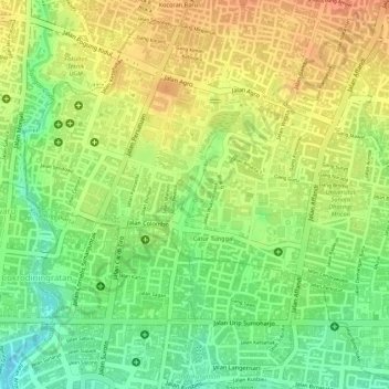
Name: Wisdom park topographic map, elevation, terrain.
Average elevation: 136 m
Minimum elevation: 107 m
Maximum elevation: 158 m
Other topographic maps
Click on a map to view its topography, its elevation and its terrain.
Janti
Indonesia > Special Region of Yogyakarta > Sleman Regency > Catur tunggal
Average elevation: 124 m
Karangmalang
Indonesia > Special Region of Yogyakarta > Sleman Regency > Catur tunggal
Average elevation: 139 m