Geolocate

Kattigenahalli topographic map

Click on the map to display elevation.

About this map

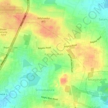
Name: Kattigenahalli topographic map, elevation, terrain.

Location: Kattigenahalli, Bengaluru, Yelahanka taluku, Bengaluru Urban District, Karnataka, 562149, India (13.09943 77.60736 13.13943 77.64736)

Average elevation: 913 m

Minimum elevation: 890 m

Maximum elevation: 935 m

Other topographic maps

Click on a map to view its topography, its elevation and its terrain.

Vidyaranyapura

India > Karnataka > Yelahanka taluku > Bengaluru

Average elevation: 920 m

Amruthalli Lake

India > Karnataka > Yelahanka taluku > Bengaluru

Average elevation: 906 m

Kodigehalli

India > Karnataka > Yelahanka taluku > Bengaluru

Average elevation: 906 m

Gear up for your next adventure:

💧Reusable Water Bottle - Durable water bottles for hydration on trails
Lightweight Camping Tent - Portable shelter optimized for Canadian backcountry camping
🥾Mountaineering Boots - Supportive boots for climbing and high-altitude hiking
🥽Outdoor Goggles - Protective eyewear for outdoor activities
🧢Outdoor Visor - Breathable visor for sunny hikes

As an Amazon Associate, this site earns from qualifying purchases at no extra cost to you.