Geolocate

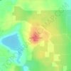
Dinner Lake topographic map

Click on the map to display elevation.

About this map

Name: Dinner Lake topographic map, elevation, terrain.

Location: Dinner Lake, Polk County, Florida, United States (27.99255 -81.78826 27.99535 -81.78479)

Average elevation: 41 m

Minimum elevation: 33 m

Maximum elevation: 52 m

Other topographic maps

Click on a map to view its topography, its elevation and its terrain.

Hillcrest Heights

United States > Florida > Polk County

Average elevation: 54 m

Lakeland

United States > Florida > Polk County > Lakeland

Average elevation: 42 m

Eagle Lake

United States > Florida > Polk County

Average elevation: 43 m

Griffin

United States > Florida > Polk County

Average elevation: 56 m

Eloise Woods

United States > Florida > Polk County

Average elevation: 43 m

Alcoma

United States > Florida > Polk County

Average elevation: 36 m

Iron Mountain

United States > Florida > Polk County

Average elevation: 60 m

Four Corners

United States > Florida > Polk County

Average elevation: 38 m

Highland Park

United States > Florida > Polk County

Average elevation: 44 m

Brewster

United States > Florida > Polk County

Average elevation: 42 m

Gear up for your next adventure:

🥾Waterproof Hiking Shoes - Durable shoes for wet and rugged trails
🪑Ultralight Camping Stool - Compact seating for rest stops during long hikes
🚲Handlebar Phone Mount - View topographic-map.com live while cycling
🎒Hiking Backpack - Lightweight and ergonomic backpacks for day hikes or multi-day treks
🥤Collapsible Travel Cup - Saves space and weight in your mess kit

As an Amazon Associate, this site earns from qualifying purchases at no extra cost to you.