Geolocate

Laoang topographic map

Click on the map to display elevation.

About this map

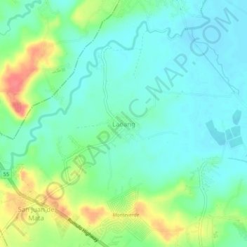
Name: Laoang topographic map, elevation, terrain.

Location: Laoang, Tarlac City, Tarlac, Central Luzon, Philippines (15.52716 120.52512 15.56716 120.56512)

Average elevation: 49 m

Minimum elevation: 30 m

Maximum elevation: 92 m

Other topographic maps

Click on a map to view its topography, its elevation and its terrain.

Maria Cristina Park

Philippines > Tarlac > Tarlac City

Average elevation: 48 m

San Rafael Creek

Philippines > Tarlac > Tarlac City

Average elevation: 41 m

Gear up for your next adventure:

🧢Hiking Hat - Sun-protective and breathable hats for long treks
🔭Compact Binoculars - Lightweight optics for scouting trails and wildlife
🧊Insulated Water Bottle - Keeps drinks cold in summer and prevents freezing in winter
🪑Insulated Seat Pad - Protect your seat from cold rocks and wet logs
🦟Insect Repellent - Keep mosquitoes and black flies away in wooded areas

As an Amazon Associate, this site earns from qualifying purchases at no extra cost to you.