Geolocate

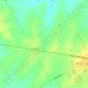
Powell topographic map

Click on the map to display elevation.

About this map

Name: Powell topographic map, elevation, terrain.

Location: Powell, Navarro County, Texas, United States (32.08331 -96.34926 32.13722 -96.29515)

Average elevation: 109 m

Minimum elevation: 93 m

Maximum elevation: 121 m

Other topographic maps

Click on a map to view its topography, its elevation and its terrain.
Prinston

United States > Texas > Navarro County > Corsicana

Average elevation: 144 m

Gear up for your next adventure:

🐕Hiking Dog Pack - Let your canine companion carry their own water and food
🧥Fleece Jacket - Warm and lightweight jacket for layering
🧰Survival Kit - Essential gear for emergencies in the wilderness
🧣Merino Neck Gaiter - Protects against wind, sun, and cold at high altitudes
🧭GPS Outdoor Watch - Smart watch for navigation and fitness tracking in nature

As an Amazon Associate, this site earns from qualifying purchases at no extra cost to you.