Geolocate

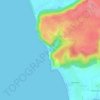
Tiracol topographic map

Click on the map to display elevation.

About this map

Name: Tiracol topographic map, elevation, terrain.

Location: Tiracol, Pernem, North Goa District, Goa, 416517, India (15.70410 73.66873 15.74410 73.70873)

Average elevation: 16 m

Minimum elevation: -3 m

Maximum elevation: 91 m

Other topographic maps

Click on a map to view its topography, its elevation and its terrain.
Arambol Sweet Water Lake

India > Goa > Pernem > Arambol

Average elevation: 25 m

Morjim Beach

India > Goa > Pernem

Average elevation: 3 m

Gear up for your next adventure:

💡LED Camping Lantern - Illuminate your campsite with long-lasting lanterns
🥾Approach Boots - Comfortable boots for hiking and climbing approaches
🧭GPS Tracker - Track your location in remote areas safely
🔭Compact Monocular - One-handed bird watching and trail spotting
📷Outdoor Action Camera - Capture high-elevation views and rugged adventures

As an Amazon Associate, this site earns from qualifying purchases at no extra cost to you.