Geolocate

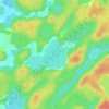
Werner Lake topographic map

Click on the map to display elevation.

About this map

Name: Werner Lake topographic map, elevation, terrain.

Location: Werner Lake, Unorganized Kenora District, Kenora District, Northwestern Ontario, Ontario, Canada (50.44156 -94.96465 50.47018 -94.85471)

Average elevation: 356 m

Minimum elevation: 314 m

Maximum elevation: 399 m

Ontario trails, hiking, mountain biking, running and outdoor activities

Other topographic maps

Click on a map to view its topography, its elevation and its terrain.
Echo Lake

Canada > Ontario > Unorganized Kenora District

Average elevation: 351 m

Gear up for your next adventure:

🥾Hiking Leggings - Comfortable leggings for outdoor activities
👖Convertible Hiking Pants - Zip-off legs to adapt to changing weather conditions
🧤Rechargeable Heated Gloves - Extreme warmth for Canadian winter expeditions
🚑Survival Whistle - Signal for help across long distances in mountains
🧼Travel Hand Sanitizer - Keep hands clean when water is scarce

As an Amazon Associate, this site earns from qualifying purchases at no extra cost to you.