Geolocate

Chimbi topographic map

Click on the map to display elevation.

About this map

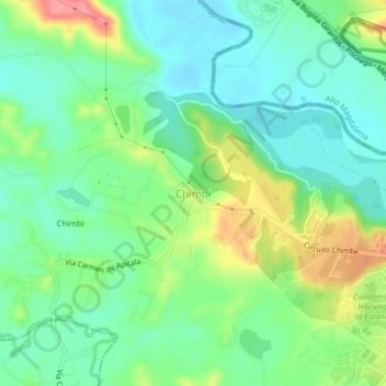
Name: Chimbi topographic map, elevation, terrain.

Location: Chimbi, Melgar, Oriente, Tolima, Región Andina, Colombia (4.18310 -74.72633 4.22310 -74.68633)

Average elevation: 304 m

Minimum elevation: 273 m

Maximum elevation: 368 m

Gear up for your next adventure:

Tent Footprint - Protect tent floor and increase durability
🧴Bear Spray Holster - Quick-access carry for essential Canadian wilderness safety
Camping Tent - Weather-resistant tents suitable for 2 to 6 people
🧢Outdoor Cap - Protective cap for sun and rain during hikes
🧥Thermal Layer - Insulating layer for cold outdoor conditions

As an Amazon Associate, this site earns from qualifying purchases at no extra cost to you.