Geolocate

Puna topographic map

Click on the map to display elevation.

About this map

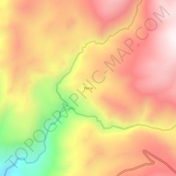
Name: Puna topographic map, elevation, terrain.

Location: Puna, Llauta, Provincia de Lucanas, Ayacucho, Perú (-14.20732 -74.89021 -14.16732 -74.85021)

Average elevation: 3,792 m

Minimum elevation: 3,152 m

Maximum elevation: 4,199 m

Gear up for your next adventure:

🔭Outdoor Binoculars - Lightweight binoculars for birdwatching and hiking
Camping Coffee Maker - Brew fresh coffee anywhere on the topographic map
🍽️Titanium Camping Spork - Ultralight and indestructible eating utensil
🥾Lightweight Hiking Boots - Boots for comfort and mobility on long hikes
👟Sport Hiking Sandals - Breathable footwear for water crossings and camp rest

As an Amazon Associate, this site earns from qualifying purchases at no extra cost to you.