Geolocate

Paulden topographic map

Click on the map to display elevation.

About this map

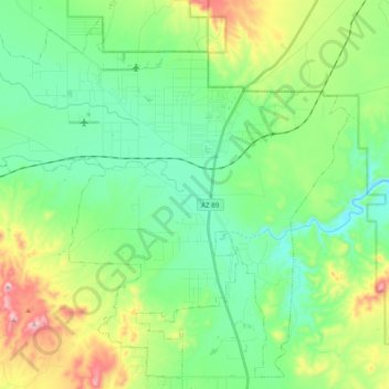
Name: Paulden topographic map, elevation, terrain.

Location: Paulden, Yavapai County, Arizona, United States (34.80443 -112.59416 34.95530 -112.39869)

Average elevation: 1,408 m

Minimum elevation: 1,277 m

Maximum elevation: 1,739 m

Gear up for your next adventure:

🔋Lithium AA Batteries - Long-lasting power that performs in extreme cold
🦯Trekking Poles - Reduced impact on joints for steep topographic climbs
🧣Merino Neck Gaiter - Protects against wind, sun, and cold at high altitudes
🧥Waterproof Hiking Jacket - Protect yourself from rain and wind while hiking
🧦Hiking Socks - Moisture-wicking and comfortable socks for long hikes

As an Amazon Associate, this site earns from qualifying purchases at no extra cost to you.