Geolocate

Plains topographic map

Click on the map to display elevation.

About this map

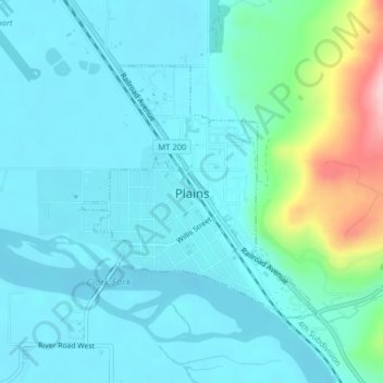
Name: Plains topographic map, elevation, terrain.

Location: Plains, Sanders County, Montana, United States (47.45176 -114.89624 47.46954 -114.87179)

Average elevation: 775 m

Minimum elevation: 742 m

Maximum elevation: 936 m

Other topographic maps

Click on a map to view its topography, its elevation and its terrain.

Border Peak

United States > Montana > Sanders County

Average elevation: 1,381 m

Quinns

United States > Montana > Sanders County

Average elevation: 1,053 m

Border Peak

United States > Montana > Sanders County

Average elevation: 1,381 m

White Pine

United States > Montana > Sanders County

Average elevation: 782 m

Gear up for your next adventure:

Camping Essentials - All-in-one gear for a comfortable camping trip
🧰Emergency Multi-Tool - Compact multi-tool for outdoor survival
🚲Handlebar Phone Mount - View topographic-map.com live while cycling
🧤Insulated Winter Gloves - Heavy-duty protection for sub-zero Canadian adventures
🧢Hiking Sun Hat - Wide-brimmed protection for exposed mountain ridges

As an Amazon Associate, this site earns from qualifying purchases at no extra cost to you.