Geolocate

Olmetto topographic map

Click on the map to display elevation.

About this map

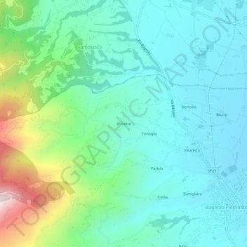
Name: Olmetto topographic map, elevation, terrain.

Location: Olmetto, Bagnolo Piemonte, Cuneo, Piemonte, 12031, Italia (44.75388 7.27047 44.79388 7.31047)

Average elevation: 494 m

Minimum elevation: 344 m

Maximum elevation: 1,002 m

Gear up for your next adventure:

🛌Insulated Sleeping Pad - Critical thermal barrier between you and the cold ground
🚲Handlebar Phone Mount - View topographic-map.com live while cycling
🧼Travel Hand Sanitizer - Keep hands clean when water is scarce
🧴Outdoor Sunscreen - High SPF protection for high-altitude UV exposure
👟Leg Gaiters - Keep debris, mud, and snow out of your boots

As an Amazon Associate, this site earns from qualifying purchases at no extra cost to you.