
Thank you for supporting this site ❤️
Make a donation
Make a donation
Gear up for your next adventure:
As an Amazon Associate, this site earns from qualifying purchases at no extra cost to you.
Belleguardello topographic map
Click on the map to display elevation.
Thank you for supporting this site ❤️
Make a donation
Make a donation
Gear up for your next adventure:
As an Amazon Associate, this site earns from qualifying purchases at no extra cost to you.
About this map
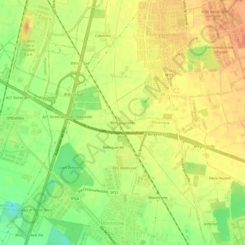
Name: Belleguardello topographic map, elevation, terrain.
Location: Belleguardello, Montirone, Brescia, Lombardy, 25010, Italy (45.44279 10.21120 45.48279 10.25120)
Average elevation: 107 m
Minimum elevation: 82 m
Maximum elevation: 123 m
Thank you for supporting this site ❤️
Make a donation
Make a donation
Gear up for your next adventure:
As an Amazon Associate, this site earns from qualifying purchases at no extra cost to you.